Trail Walking Hem-Lenglet - Boucle des marais de Féchain - Photo

Boucle des marais de Féchain

© OpenStreetMap contributors
Length
Length
7.3 km
Max alt
Max alt
43 m
Uphill gradient
Uphill gradient
45 m
Km-Effort
Km-Effort  
7.9 km
Min alt
Min alt
31 m
Downhill gradient
Downhill gradient
44 m
Boucle
Boucle
Yes
Creation date :
2021-04-25 09:03:46.747
Updated on :
2021-04-25 09:05:30.662

(0 Reviews)

Walking
Walking
1h48
Difficulty : Medium

Scan this QR Code to open this trail in the SityTrail application

FREE GPS app for hiking

Logo SityTrail SityTrail

IGN / Geographical institutes

Download SityTrail from the App Store Download SityTrail from Google Play

Logo SityTrail SityTrail World

The world is yours!

Download SityTrail from the App Store Download SityTrail from Google Play Download SityTrail on Huawei AppGallery

About

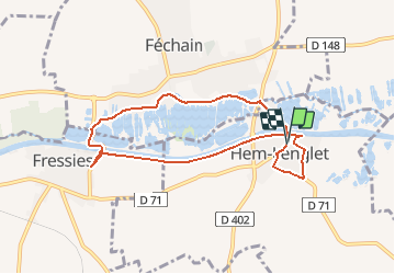
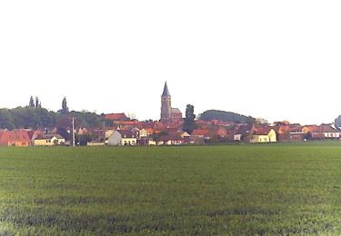
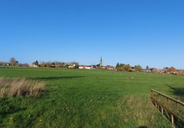
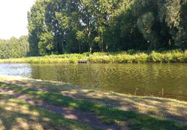
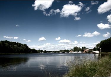
Trail Walking of 7.3 km to be discovered at Hauts-de-France, Nord, Hem-Lenglet. This trail is proposed by BrassensJC.

Description

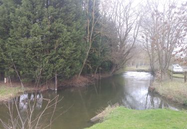
au départ de l’église d'Hem-Lenglet et retour par Fressies et le canal.

Elevation profile

Positioning

Country:
France
Region :
Hauts-de-France
Department/Province :
Nord
Municipality :
Hem-Lenglet
Location:
Unknown
Start:(UTM)
516354 ; 5567442 (31U) N.

Trails nearby

Trail Walking Paillencourt - petite boucle paillencourt - Photo
Walking
terminio

Walking

Very easy
Paillencourt, Hauts-de-France, Nord, France
3.4 km | 3.7 km-effort
57min
Yes
Trail Walking Aubigny-au-Bac - A la frontière de l'eau -  Aubigny-au-Bac - Photo
Walking
tracegps

Walking

Medium
Aubigny-au-Bac, Hauts-de-France, Nord, France
9.5 km | 10.3 km-effort
2h 30min
Yes
Trail Walking Villers-au-Tertre - Au départ du Mont Tilleul  (Villers-au-tertre) - Photo
Walking
tracegps

Walking

Easy
Villers-au-Tertre, Hauts-de-France, Nord, France
8.7 km | 9.5 km-effort
2h 0min
Yes
Trail Walking Aubigny-au-Bac - Aubigny au Bac - Photo
Walking
Morelli

Walking

Difficult
(1)
Aubigny-au-Bac, Hauts-de-France, Nord, France
23 km | 25 km-effort
6h 0min
Yes
Trail Walking Paillencourt - paillencourt - Photo
Walking
terminio

Walking

Very easy
Paillencourt, Hauts-de-France, Nord, France
3.4 km | 3.7 km-effort
48min
Yes
Trail Mountain bike Bouchain - VTT en Ostrevant (Bouchain) - Photo
Mountain bike
tracegps

Mountain bike

Medium
Bouchain, Hauts-de-France, Nord, France
23 km | 24 km-effort
2h 19min
Yes
Trail Walking Paillencourt - Canaux et marais autour de PAILLENCOURT - Photo
Walking
temmichel

Walking

Difficult
(1)
Paillencourt, Hauts-de-France, Nord, France
13.1 km | 14.2 km-effort
3h 13min
Yes
Trail Walking Fressies - fressies - Photo
Walking
terminio

Walking

Easy
Fressies, Hauts-de-France, Nord, France
4.9 km | 5.3 km-effort
1h 10min
Yes
Trail Walking Féchain - Randonnée tranquille le long du Canal de Sensée.  - Photo
Walking
FBst2432872

Walking

Easy
Féchain, Hauts-de-France, Nord, France
5.2 km | 5.7 km-effort
1h 26min
Yes


Close
My subscriptions