


Chitenay 2

Rolland Jean Pierre
User

Length
11.1 km

Max alt
102 m

Uphill gradient
98 m
Km-Effort
12.4 km

Min alt
76 m

Downhill gradient
97 m
Boucle
Yes
Creation date :
2021-04-25 09:20:08.959
Updated on :
2021-04-25 09:20:56.875
2h49
Difficulty : Difficult

FREE GPS app for hiking
 SityTrail
IGN / Geographical institutes
SityTrail Plus
The world is yours!
About
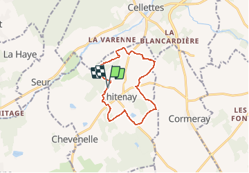
Trail Walking of 11.1 km to be discovered at Centre-Loire Valley, Loir-et-Cher, Chitenay. This trail is proposed by Rolland Jean Pierre .
Description
Marche
Positioning
Country:
France
Region :
Centre-Loire Valley
Department/Province :
Loir-et-Cher
Municipality :
Chitenay
Location:
Unknown
Start:(Dec)
Start:(UTM)
376995 ; 5262082 (31T) N.
Comments