


Izeaux-chemin du pendu

raymondfn
User

Length
6.8 km

Max alt
441 m

Uphill gradient
39 m
Km-Effort
7.4 km

Min alt
411 m

Downhill gradient
39 m
Boucle
Yes
Creation date :
2021-04-26 14:39:25.785
Updated on :
2023-02-04 09:31:20.956
1h42
Difficulty : Medium

FREE GPS app for hiking
 SityTrail
IGN / Geographical institutes
SityTrail Plus
The world is yours!
About
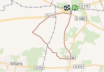
Trail Walking of 6.8 km to be discovered at Auvergne-Rhône-Alpes, Isère, Izeaux. This trail is proposed by raymondfn.
Positioning
Country:
France
Region :
Auvergne-Rhône-Alpes
Department/Province :
Isère
Municipality :
Izeaux
Location:
Unknown
Start:(Dec)
Start:(UTM)
689838 ; 5026218 (31T) N.
Comments