


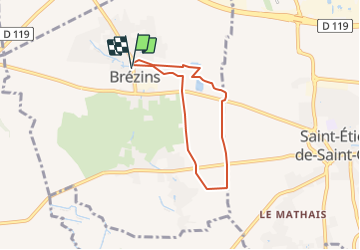
Brézins-Petit Bessey

raymondfn
User

Length
5.6 km

Max alt
401 m

Uphill gradient
46 m
Km-Effort
6.2 km

Min alt
364 m

Downhill gradient
45 m
Boucle
Yes
Creation date :
2021-04-26 15:13:08.328
Updated on :
2022-01-05 10:07:28.207
1h48
Difficulty : Medium

FREE GPS app for hiking
 SityTrail
IGN / Geographical institutes
SityTrail Plus
The world is yours!
About
Trail Walking of 5.6 km to be discovered at Auvergne-Rhône-Alpes, Isère, Brézins. This trail is proposed by raymondfn.
Positioning
Country:
France
Region :
Auvergne-Rhône-Alpes
Department/Province :
Isère
Municipality :
Brézins
Location:
Unknown
Start:(Dec)
Start:(UTM)
680714 ; 5024362 (31T) N.
Comments