


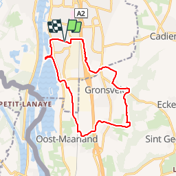
Maastricht 13km?
© OpenStreetMap contributors


--
Difficulty : Unknown


Length
12.9 km
Max alt
109 m
Uphill gradient
109 m
Km-Effort
14.4 km
Min alt
43 m
Downhill gradient
110 m
Boucle
Yes
Creation date :
2014-12-10 00:00:00.0
Updated on :
2014-12-10 00:00:00.0
--
Difficulty : Unknown
FREE GPS app for hiking
 SityTrail
IGN / Geographical institutes
SityTrail Plus
The world is yours!
About
Trail Walking of 12.9 km to be discovered at Limburg, Unknown, Maastricht. This trail is proposed by wandelgidszuidlimburg.
Description
More information on : http://www.wandelgidszuidlimburg.com


Positioning
Country:
Netherlands
Region :
Limburg
Department/Province :
Unknown
Municipality :
Maastricht
Location:
Unknown
Start:(Dec)
Start:(UTM)
690857 ; 5633990 (31U) N.
Comments
Très belle boucle. Juste une petite déviation suite à la disparition d'un sentier avec la construction de 2 usines.