


2021-04-21 mesigny

Lucquiaud
User

Length
9.7 km

Max alt
716 m

Uphill gradient
269 m
Km-Effort
13.3 km

Min alt
533 m

Downhill gradient
270 m
Boucle
Yes
Creation date :
2021-04-26 13:41:20.397
Updated on :
2021-04-27 12:18:14.347
3h50
Difficulty : Easy

FREE GPS app for hiking
 SityTrail
IGN / Geographical institutes
SityTrail Plus
The world is yours!
About
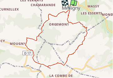
Trail Walking of 9.7 km to be discovered at Auvergne-Rhône-Alpes, Upper Savoy, Mésigny. This trail is proposed by Lucquiaud.
Positioning
Country:
France
Region :
Auvergne-Rhône-Alpes
Department/Province :
Upper Savoy
Municipality :
Mésigny
Location:
Unknown
Start:(Dec)
Start:(UTM)
268020 ; 5096936 (32T) N.
Comments