


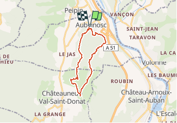
Boucle des Canayons depart Aubignosc 390 +

claude nier
User

Length
12.5 km

Max alt
692 m

Uphill gradient
384 m
Km-Effort
17.7 km

Min alt
472 m

Downhill gradient
384 m
Boucle
Yes
Creation date :
2021-04-22 07:19:53.785
Updated on :
2021-04-27 16:37:13.49
128h07
Difficulty : Easy

FREE GPS app for hiking
 SityTrail
IGN / Geographical institutes
SityTrail Plus
The world is yours!
About
Trail Walking of 12.5 km to be discovered at Provence-Alpes-Côte d'Azur, Alpes-de-Haute-Provence, Aubignosc. This trail is proposed by claude nier.
Description
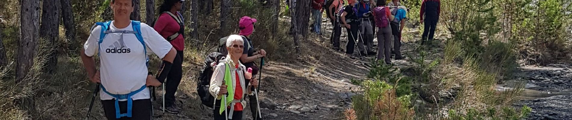
rando sympa et pas crevant...que du bonheur
Photos


Positioning
Country:
France
Region :
Provence-Alpes-Côte d'Azur
Department/Province :
Alpes-de-Haute-Provence
Municipality :
Aubignosc
Location:
Unknown
Start:(Dec)
Start:(UTM)
737490 ; 4890444 (31T) N.
Comments