


Mt Vinaigre et Suvières depuis Roussiveau

ETMU5496
User
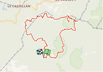

Length
26 km

Max alt
600 m

Uphill gradient
963 m
Km-Effort
39 km

Min alt
68 m

Downhill gradient
960 m
Boucle
Yes
Creation date :
2021-04-28 06:34:40.0
Updated on :
2021-04-28 16:18:58.367
5h54
Difficulty : Difficult

FREE GPS app for hiking
 SityTrail
IGN / Geographical institutes
SityTrail Plus
The world is yours!
About
Trail Walking of 26 km to be discovered at Provence-Alpes-Côte d'Azur, Var, Saint-Raphaël. This trail is proposed by ETMU5496.
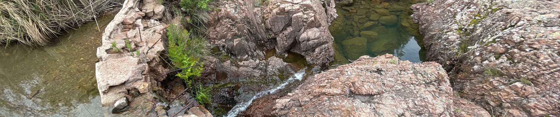
Photos


Positioning
Country:
France
Region :
Provence-Alpes-Côte d'Azur
Department/Province :
Var
Municipality :
Saint-Raphaël
Location:
Unknown
Start:(Dec)
Start:(UTM)
325321 ; 4815191 (32T) N.
Comments