


Bastide blanche - Janet

Berpav
User
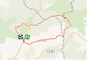

Length
9.4 km

Max alt
478 m

Uphill gradient
237 m
Km-Effort
12.6 km

Min alt
309 m

Downhill gradient
238 m
Boucle
Yes
Creation date :
2021-04-30 13:44:28.266
Updated on :
2021-04-30 13:45:13.695
2h51
Difficulty : Medium

FREE GPS app for hiking
 SityTrail
IGN / Geographical institutes
SityTrail Plus
The world is yours!
About
Trail Walking of 9.4 km to be discovered at Provence-Alpes-Côte d'Azur, Bouches-du-Rhône, Lambesc. This trail is proposed by Berpav.
Positioning
Country:
France
Region :
Provence-Alpes-Côte d'Azur
Department/Province :
Bouches-du-Rhône
Municipality :
Lambesc
Location:
Unknown
Start:(Dec)
Start:(UTM)
683439 ; 4838519 (31T) N.
Comments
bel randonnée