


domaine Galy

Mascart
User

Length
10.6 km

Max alt
237 m

Uphill gradient
166 m
Km-Effort
12.8 km

Min alt
118 m

Downhill gradient
167 m
Boucle
Yes
Creation date :
2021-04-30 12:37:05.425
Updated on :
2021-04-30 15:12:49.552
2h32
Difficulty : Medium

FREE GPS app for hiking
 SityTrail
IGN / Geographical institutes
SityTrail Plus
The world is yours!
About
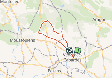
Trail Walking of 10.6 km to be discovered at Occitania, Aude, Ventenac-Cabardès. This trail is proposed by Mascart.
Description
via Valeron
Positioning
Country:
France
Region :
Occitania
Department/Province :
Aude
Municipality :
Ventenac-Cabardès
Location:
Unknown
Start:(Dec)
Start:(UTM)
441991 ; 4790539 (31T) N.
Comments