


FERRIERES

jpblimond
User
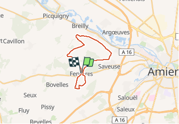

Length
18.8 km

Max alt
118 m

Uphill gradient
198 m
Km-Effort
21 km

Min alt
31 m

Downhill gradient
198 m
Boucle
Yes
Creation date :
2021-05-02 10:50:40.0
Updated on :
2021-05-02 16:05:28.042
4h40
Difficulty : Medium

FREE GPS app for hiking
 SityTrail
IGN / Geographical institutes
SityTrail Plus
The world is yours!
About
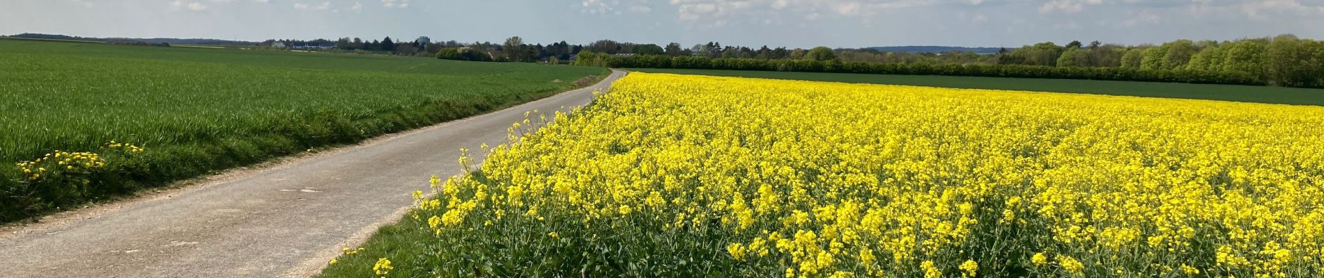
Trail Walking of 18.8 km to be discovered at Hauts-de-France, Somme, Ferrières. This trail is proposed by jpblimond.
Photos


Positioning
Country:
France
Region :
Hauts-de-France
Department/Province :
Somme
Municipality :
Ferrières
Location:
Unknown
Start:(Dec)
Start:(UTM)
440925 ; 5527009 (31U) N.
Comments