


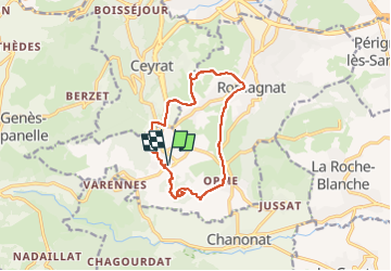
Saulzet_Chaud_Giroux_Montrognon

jagarnier
User GUIDE


3h30
Difficulty : Medium

FREE GPS app for hiking
 SityTrail
IGN / Geographical institutes
SityTrail Plus
The world is yours!
About
Trail Walking of 11.8 km to be discovered at Auvergne-Rhône-Alpes, Puy-de-Dôme, Romagnat. This trail is proposed by jagarnier.
Description
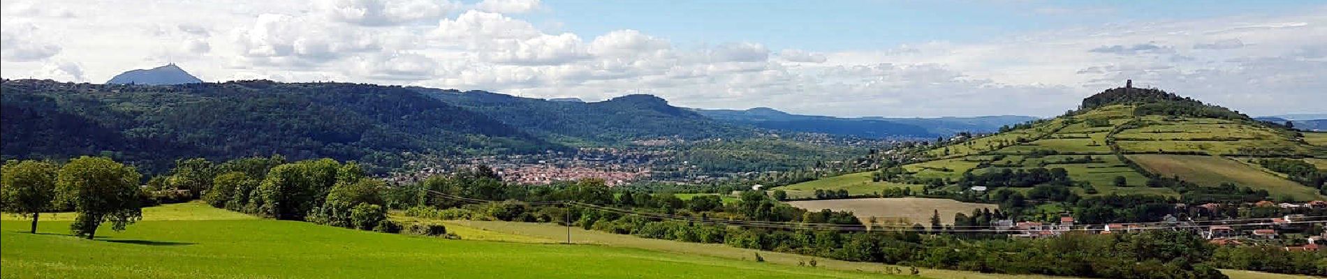
Cette randonnée passe par l'ascension de deux volcans, le Puy Giroux et le Montrognon. Vous pourrez profiter de magnifiques panoramas. Ce parcours permet aussi de découvrir plusieurs villages (Saulzet, Opme et Romagnat) par un itinéraire qui emprunte des chemins en forêt.
Photos

Positioning
Comments