


20-AVR-18 04:13:32 PM

mhetpierre
User
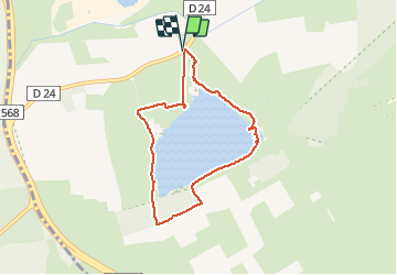

Length
7 km

Max alt
25 m

Uphill gradient
44 m
Km-Effort
7.6 km

Min alt
8 m

Downhill gradient
44 m
Boucle
Yes
Creation date :
2021-05-04 12:06:47.227
Updated on :
2021-05-04 12:10:02.067
1h43
Difficulty : Easy

FREE GPS app for hiking
 SityTrail
IGN / Geographical institutes
SityTrail Plus
The world is yours!
About
Trail On foot of 7 km to be discovered at Provence-Alpes-Côte d'Azur, Bouches-du-Rhône, Saint-Martin-de-Crau. This trail is proposed by mhetpierre.
Positioning
Country:
France
Region :
Provence-Alpes-Côte d'Azur
Department/Province :
Bouches-du-Rhône
Municipality :
Saint-Martin-de-Crau
Location:
Unknown
Start:(Dec)
Start:(UTM)
644336 ; 4829215 (31T) N.
Comments