


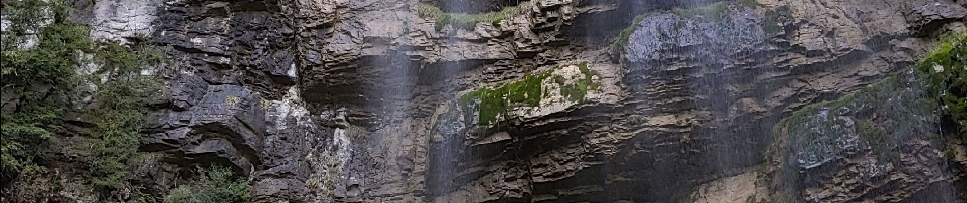
malleval Bec de neurre

bymarc26
User
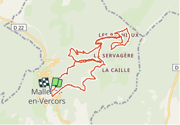

Length
12.8 km

Max alt
1232 m

Uphill gradient
726 m
Km-Effort
22 km

Min alt
787 m

Downhill gradient
725 m
Boucle
Yes
Creation date :
2021-05-06 07:04:17.611
Updated on :
2021-05-06 12:25:35.612
3h34
Difficulty : Easy

FREE GPS app for hiking
 SityTrail
IGN / Geographical institutes
SityTrail Plus
The world is yours!
About
Trail Walking of 12.8 km to be discovered at Auvergne-Rhône-Alpes, Isère, Malleval-en-Vercors. This trail is proposed by bymarc26.
Photos


Positioning
Country:
France
Region :
Auvergne-Rhône-Alpes
Department/Province :
Isère
Municipality :
Malleval-en-Vercors
Location:
Unknown
Start:(Dec)
Start:(UTM)
691723 ; 5002301 (31T) N.
Comments