


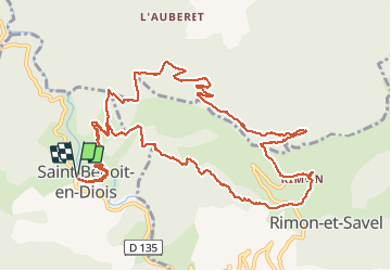
26 St Benoît Pas de Pousterle Col de la Graye Rimon C1

HAL26
User

Length
15.2 km

Max alt
1053 m

Uphill gradient
917 m
Km-Effort
27 km

Min alt
348 m

Downhill gradient
918 m
Boucle
Yes
Creation date :
2021-05-06 07:40:05.167
Updated on :
2021-05-06 16:43:00.393
4h29
Difficulty : Medium

FREE GPS app for hiking
 SityTrail
IGN / Geographical institutes
SityTrail Plus
The world is yours!
About
Trail Walking of 15.2 km to be discovered at Auvergne-Rhône-Alpes, Drôme, Saint-Benoit-en-Diois. This trail is proposed by HAL26.
Positioning
Country:
France
Region :
Auvergne-Rhône-Alpes
Department/Province :
Drôme
Municipality :
Saint-Benoit-en-Diois
Location:
Unknown
Start:(Dec)
Start:(UTM)
680115 ; 4948072 (31T) N.
Comments