


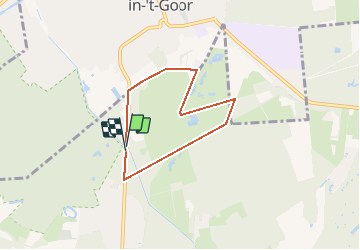
sGravenwezel Rinkvenpad - 5 km RT

wandelroutes
User

Length
4.9 km

Max alt
26 m

Uphill gradient
36 m
Km-Effort
5.3 km

Min alt
13 m

Downhill gradient
35 m
Boucle
Yes
Creation date :
2014-12-10 00:00:00.0
Updated on :
2014-12-10 00:00:00.0
--
Difficulty : Unknown

FREE GPS app for hiking
 SityTrail
IGN / Geographical institutes
SityTrail Plus
The world is yours!
About
Trail Walking of 4.9 km to be discovered at Flanders, Antwerp, Schilde. This trail is proposed by wandelroutes.
Description
More information on : http://www.wandelroutes.org


Positioning
Country:
Belgium
Region :
Flanders
Department/Province :
Antwerp
Municipality :
Schilde
Location:
's-Gravenwezel
Start:(Dec)
Start:(UTM)
609513 ; 5682064 (31U) N.
Comments