


Tracé actuel: 10 JAN 2021 11:36

Luberon1963
User
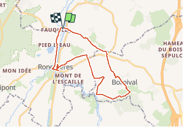

Length
14 km

Max alt
139 m

Uphill gradient
227 m
Km-Effort
17 km

Min alt
52 m

Downhill gradient
229 m
Boucle
Yes
Creation date :
2021-05-08 14:24:46.867
Updated on :
2021-05-08 14:31:28.266
3h52
Difficulty : Difficult

FREE GPS app for hiking
 SityTrail
IGN / Geographical institutes
SityTrail Plus
The world is yours!
About
Trail Walking of 14 km to be discovered at Wallonia, Walloon Brabant, Ittre. This trail is proposed by Luberon1963.
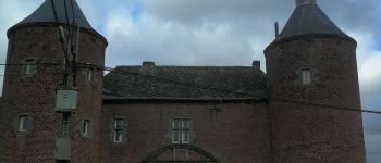
Photos


Positioning
Country:
Belgium
Region :
Wallonia
Department/Province :
Walloon Brabant
Municipality :
Ittre
Location:
Ittre
Start:(Dec)
Start:(UTM)
586928 ; 5608808 (31U) N.
Comments