


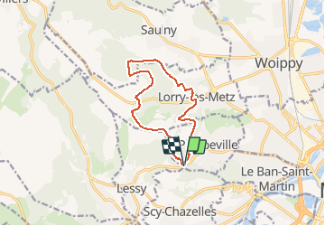
Col de Lessy BS 10 km

bstebe
User

Length
10.2 km

Max alt
356 m

Uphill gradient
227 m
Km-Effort
13.2 km

Min alt
216 m

Downhill gradient
227 m
Boucle
Yes
Creation date :
2021-05-10 13:00:02.996
Updated on :
2021-05-10 13:02:04.422
3h00
Difficulty : Difficult

FREE GPS app for hiking
 SityTrail
IGN / Geographical institutes
SityTrail Plus
The world is yours!
About
Trail Walking of 10.2 km to be discovered at Grand Est, Moselle, Plappeville. This trail is proposed by bstebe.
Description
Rando circulaire depuis le col de Lessy
Positioning
Country:
France
Region :
Grand Est
Department/Province :
Moselle
Municipality :
Plappeville
Location:
Unknown
Start:(Dec)
Start:(UTM)
289582 ; 5445423 (32U) N.
Comments