Trail Walking Villes-sur-Auzon - Contreforts du ventoux  - Photo
© OpenStreetMap contributors
Length
Length
13.3 km
Max alt
Max alt
709 m
Uphill gradient
Uphill gradient
418 m
Km-Effort
Km-Effort  
18.9 km
Min alt
Min alt
297 m
Downhill gradient
Downhill gradient
416 m
Boucle
Boucle
Yes
Creation date :
2021-05-12 09:27:28.0
Updated on :
2021-05-12 12:29:48.113

(0 Reviews)

Walking
Walking
2h43
Difficulty : Difficult

Scan this QR Code to open this trail in the SityTrail application

FREE GPS app for hiking

Logo SityTrail SityTrail

IGN / Geographical institutes

Download SityTrail from the App Store Download SityTrail from Google Play

Logo SityTrail SityTrail World

The world is yours!

Download SityTrail from the App Store Download SityTrail from Google Play Download SityTrail on Huawei AppGallery

About

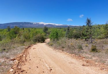
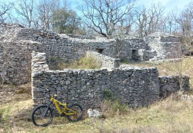
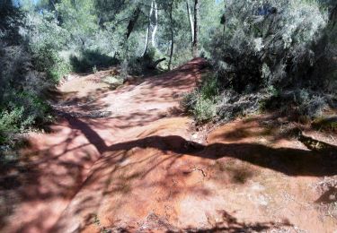
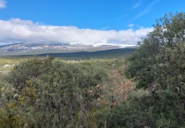
Trail Walking of 13.3 km to be discovered at Provence-Alpes-Côte d'Azur, Vaucluse, Villes-sur-Auzon. This trail is proposed by Lionel DAVIN.

Description

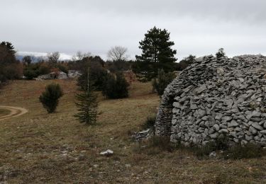
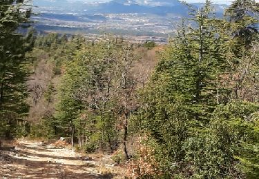
Au départ de villes sur auzon, quelques belles vues sur la plaine et le ventoux

Elevation profile

Photos

Positioning

Country:
France
Region :
Provence-Alpes-Côte d'Azur
Department/Province :
Vaucluse
Municipality :
Villes-sur-Auzon
Location:
Unknown
Start:(UTM)
679023 ; 4880762 (31T) N.

Trails nearby

Trail Walking Villes-sur-Auzon - villes sur auzon - Photo
Walking
Vero7684

Walking

Difficult
(1)
Villes-sur-Auzon, Provence-Alpes-Côte d'Azur, Vaucluse, France
22 km | 31 km-effort
6h 18min
Yes
Trail Walking Villes-sur-Auzon - LES ESCAMPEAUX - Photo
Walking
FLORENSAC

Walking

Medium
(1)
Villes-sur-Auzon, Provence-Alpes-Côte d'Azur, Vaucluse, France
14.9 km | 21 km-effort
4h 50min
Yes
Trail Walking Méthamis - De Méthamis au four à chaux par la Gorge de la Nesque - Photo
Walking
tracegps

Walking

Medium
(1)
Méthamis, Provence-Alpes-Côte d'Azur, Vaucluse, France
12.7 km | 16.9 km-effort
4h 30min
Yes
Trail Walking Mormoiron - Ballade for Friends - Photo
Walking
supercolas

Walking

Medium
(1)
Mormoiron, Provence-Alpes-Côte d'Azur, Vaucluse, France
7.3 km | 9 km-effort
2h 2min
Yes
Trail Walking Mormoiron - Ocres et forêt  - Photo
Walking
supercolas

Walking

Easy
Mormoiron, Provence-Alpes-Côte d'Azur, Vaucluse, France
4.9 km | 6.2 km-effort
1h 8min
Yes
Trail Mountain bike Mormoiron - La Tête à Jeannot !!!! - Photo
Mountain bike
supercolas

Mountain bike

Difficult
Mormoiron, Provence-Alpes-Côte d'Azur, Vaucluse, France
36 km | 51 km-effort
2h 55min
Yes
Trail Mountain bike Mormoiron - La Colombie Britannique Provençale - Photo
Mountain bike
supercolas

Mountain bike

Medium
Mormoiron, Provence-Alpes-Côte d'Azur, Vaucluse, France
30 km | 42 km-effort
2h 18min
No
Trail Walking Mormoiron - Boucle des ocres du ravin des Sitos - Photo
Walking
rigol05

Walking

Medium
Mormoiron, Provence-Alpes-Côte d'Azur, Vaucluse, France
7.5 km | 10.4 km-effort
2h 15min
Yes
Trail Walking Flassan - Sentiers sauvages de la Combe Ripert - Photo
Walking
supercolas

Walking

Medium
Flassan, Provence-Alpes-Côte d'Azur, Vaucluse, France
8.5 km | 13.5 km-effort
2h 20min
Yes


Close
My subscriptions