


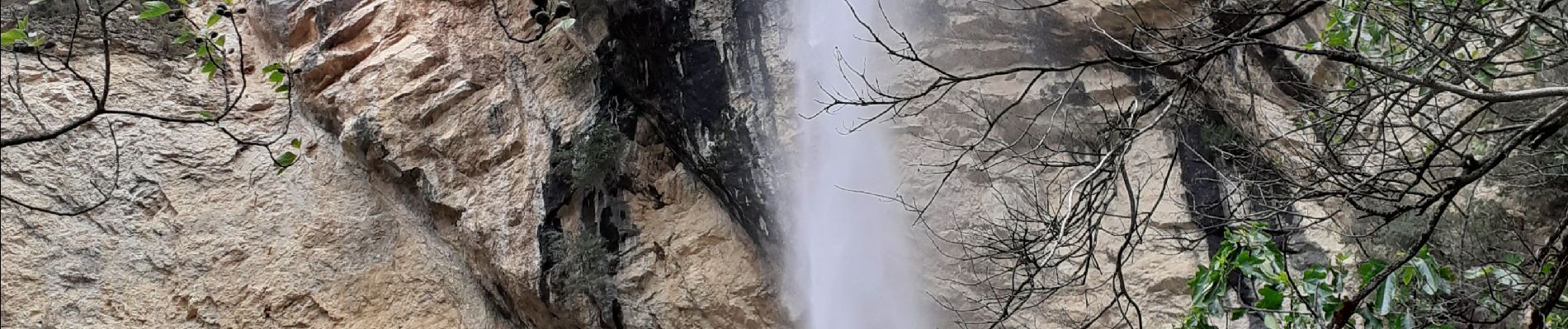
Cacade de Pissevielle St Remeze

cousam
User
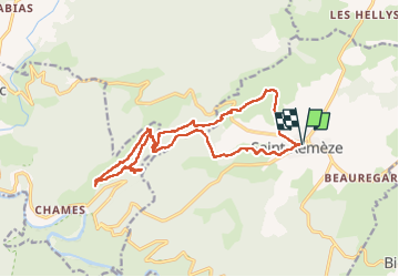

Length
18.9 km

Max alt
513 m

Uphill gradient
703 m
Km-Effort
28 km

Min alt
102 m

Downhill gradient
702 m
Boucle
Yes
Creation date :
2021-05-12 07:35:10.93
Updated on :
2022-06-18 07:18:40.656
7h33
Difficulty : Medium

FREE GPS app for hiking
 SityTrail
IGN / Geographical institutes
SityTrail Plus
The world is yours!
About
Trail Walking of 18.9 km to be discovered at Auvergne-Rhône-Alpes, Ardèche, Saint-Remèze. This trail is proposed by cousam.
Description
A partir du KM 14 ,traverser 15 fois le ruisseau des fonts (à gué) jusqu'à St Remeze ! (problème en cas de grosse pluie)
Photos


Positioning
Country:
France
Region :
Auvergne-Rhône-Alpes
Department/Province :
Ardèche
Municipality :
Saint-Remèze
Location:
Unknown
Start:(Dec)
Start:(UTM)
619718 ; 4916572 (31T) N.
Comments