


cezas

Bwattier
User
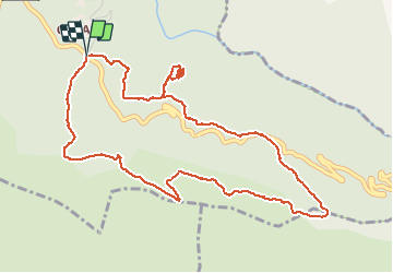

Length
6.2 km

Max alt
685 m

Uphill gradient
244 m
Km-Effort
9.5 km

Min alt
492 m

Downhill gradient
247 m
Boucle
Yes
Creation date :
2021-05-13 12:00:21.299
Updated on :
2021-05-13 14:38:50.852
2h36
Difficulty : Medium

FREE GPS app for hiking
 SityTrail
IGN / Geographical institutes
SityTrail Plus
The world is yours!
About
Trail Walking of 6.2 km to be discovered at Occitania, Gard, Sumène. This trail is proposed by Bwattier.
Positioning
Country:
France
Region :
Occitania
Department/Province :
Gard
Municipality :
Sumène
Location:
Unknown
Start:(Dec)
Start:(UTM)
562454 ; 4869418 (31T) N.
Comments