


Randonnée l'après-midi

holtzv
User GUIDE
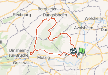

Length
17 km

Max alt
358 m

Uphill gradient
422 m
Km-Effort
23 km

Min alt
173 m

Downhill gradient
422 m
Boucle
Yes
Creation date :
2021-05-14 07:16:30.248
Updated on :
2021-05-14 07:29:24.776
5h09
Difficulty : Very difficult

FREE GPS app for hiking
 SityTrail
IGN / Geographical institutes
SityTrail Plus
The world is yours!
About
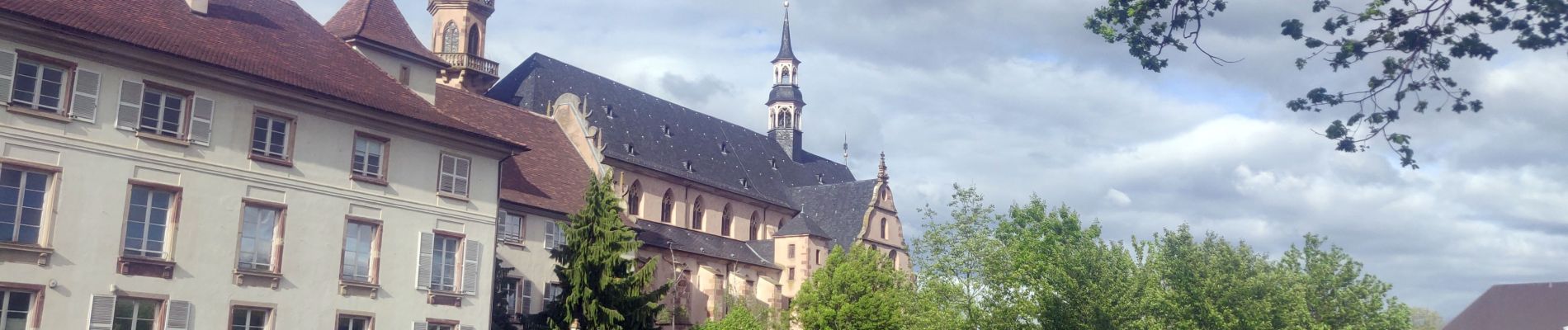
Trail Walking of 17 km to be discovered at Grand Est, Bas-Rhin, Molsheim. This trail is proposed by holtzv.
Photos


Positioning
Country:
France
Region :
Grand Est
Department/Province :
Bas-Rhin
Municipality :
Molsheim
Location:
Unknown
Start:(Dec)
Start:(UTM)
388903 ; 5377360 (32U) N.
Comments