Trail Walking Saint-Martin-de-l'Arçon - Gorges de Colombieres et d Heric - Photo

Gorges de Colombieres et d Heric

© OpenStreetMap contributors
Length
Length
23 km
Max alt
Max alt
1066 m
Uphill gradient
Uphill gradient
1108 m
Km-Effort
Km-Effort  
38 km
Min alt
Min alt
175 m
Downhill gradient
Downhill gradient
1109 m
Boucle
Boucle
Yes
Creation date :
2021-05-14 07:57:52.0
Updated on :
2021-05-17 20:23:46.398

(0 Reviews)

Walking
Walking
6h00
Difficulty : Very difficult

Scan this QR Code to open this trail in the SityTrail application

FREE GPS app for hiking

Logo SityTrail SityTrail

IGN / Geographical institutes

Download SityTrail from the App Store Download SityTrail from Google Play

Logo SityTrail SityTrail Plus

The world is yours!

Download SityTrail from the App Store Download SityTrail from Google Play Download SityTrail on Huawei AppGallery

About

Trail Walking of 23 km to be discovered at Occitania, Hérault, Saint-Martin-de-l'Arçon. This trail is proposed by philvidal.

Description

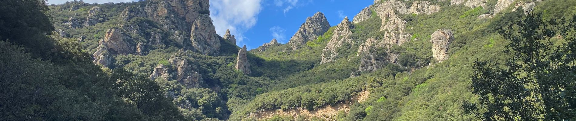
Magnifique randonnée vers le Mont Caroux dans le massif de l'Espinousse. Possibilité de se baigner dans les Gorges.
La randonnée est exceptionnelle.
   Montée pars les gorges de Colombières
   Traversée par le plateau de l'Espinousse
   Descente par les gorges d'Héric
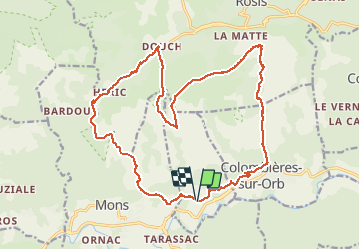
Longueur 23 km avec 1 100 m de dénivelé
Fait le 22 Mai 2021
Temps de marche 6h00, 8h00 avec pauses

Elevation profile

Photos

Positioning

Country:
France
Region :
Occitania
Department/Province :
Hérault
Municipality :
Saint-Martin-de-l'Arçon
Location:
Unknown
Start:(UTM)
498863 ; 4824368 (31T) N.


Close
My subscriptions