


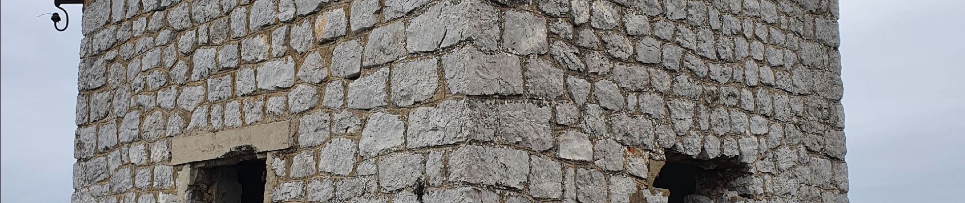
la tour des Opies

amiral13
User GUIDE
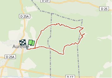

Length
7.9 km

Max alt
479 m

Uphill gradient
341 m
Km-Effort
12.4 km

Min alt
141 m

Downhill gradient
339 m
Boucle
Yes
Creation date :
2021-05-15 09:11:56.865
Updated on :
2021-05-15 17:30:54.237
4h00
Difficulty : Medium

FREE GPS app for hiking
 SityTrail
IGN / Geographical institutes
SityTrail Plus
The world is yours!
About
Trail Walking of 7.9 km to be discovered at Provence-Alpes-Côte d'Azur, Bouches-du-Rhône, Aureille. This trail is proposed by amiral13.
Photos


Positioning
Country:
France
Region :
Provence-Alpes-Côte d'Azur
Department/Province :
Bouches-du-Rhône
Municipality :
Aureille
Location:
Unknown
Start:(Dec)
Start:(UTM)
657211 ; 4841054 (31T) N.
Comments