


GRP_Lanvaux_AH_08_Rochefort-Terre_Limerzel_20210515

patrickdanilo
User
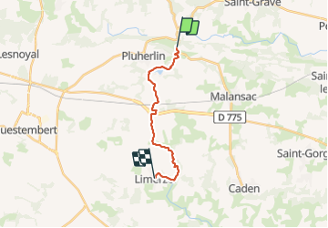

Length
13.5 km

Max alt
94 m

Uphill gradient
223 m
Km-Effort
16.3 km

Min alt
26 m

Downhill gradient
185 m
Boucle
No
Creation date :
2021-05-15 08:24:53.533
Updated on :
2022-02-09 14:27:02.2
3h28
Difficulty : Easy

FREE GPS app for hiking
 SityTrail
IGN / Geographical institutes
SityTrail Plus
The world is yours!
About
Trail Walking of 13.5 km to be discovered at Brittany, Morbihan, Pluherlin. This trail is proposed by patrickdanilo.
Description
GRP© Vannes-Lanvaux
Boucle
De Vannes (Morbihan) Bretagne
à Vannes (Morbihan) Bretagne
200 km
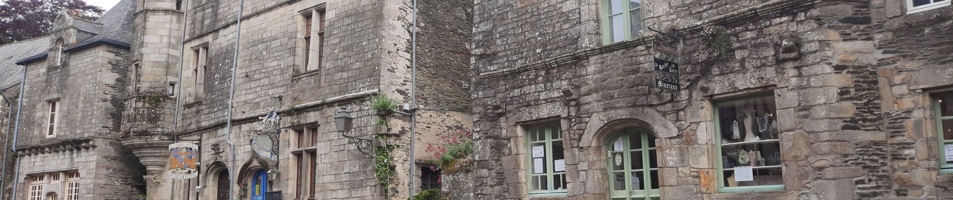
Photos


Positioning
Country:
France
Region :
Brittany
Department/Province :
Morbihan
Municipality :
Pluherlin
Location:
Unknown
Start:(Dec)
Start:(UTM)
549693 ; 5283432 (30T) N.
Comments