


st Guilhem autre

bouscaillou
User
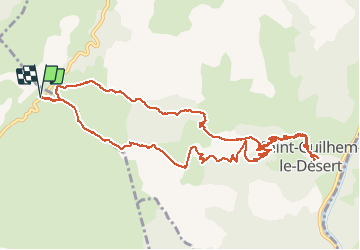

Length
13.9 km

Max alt
561 m

Uphill gradient
584 m
Km-Effort
22 km

Min alt
104 m

Downhill gradient
583 m
Boucle
Yes
Creation date :
2021-05-15 08:04:48.256
Updated on :
2021-05-15 15:02:12.906
6h26
Difficulty : Very difficult

FREE GPS app for hiking
 SityTrail
IGN / Geographical institutes
SityTrail Plus
The world is yours!
About
Trail Walking of 13.9 km to be discovered at Occitania, Hérault, Montpeyroux. This trail is proposed by bouscaillou.
Positioning
Country:
France
Region :
Occitania
Department/Province :
Hérault
Municipality :
Montpeyroux
Location:
Unknown
Start:(Dec)
Start:(UTM)
540430 ; 4843277 (31T) N.
Comments