Trail Walking Villapourçon - w-frankrijk-bron-van-de-yonne - Photo

w-frankrijk-bron-van-de-yonne

© OpenStreetMap contributors
Length
Length
7.2 km
Max alt
Max alt
790 m
Uphill gradient
Uphill gradient
235 m
Km-Effort
Km-Effort  
10.3 km
Min alt
Min alt
583 m
Downhill gradient
Downhill gradient
230 m
Boucle
Boucle
Yes
Creation date :
2014-12-10 00:00:00.0
Updated on :
2014-12-10 00:00:00.0

(1 Reviews)

Walking
Walking
--
Difficulty : Unknown

Scan this QR Code to open this trail in the SityTrail application

FREE GPS app for hiking

Logo SityTrail SityTrail

IGN / Geographical institutes

Download SityTrail from the App Store Download SityTrail from Google Play

Logo SityTrail SityTrail World

The world is yours!

Download SityTrail from the App Store Download SityTrail from Google Play Download SityTrail on Huawei AppGallery

About

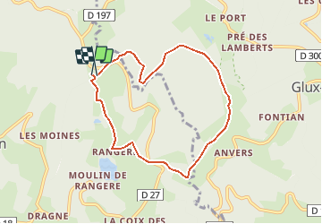
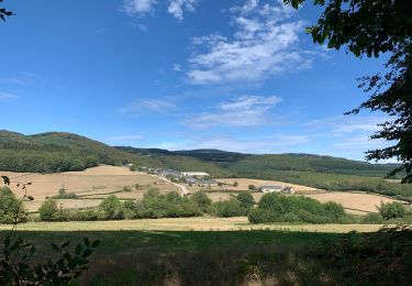
Trail Walking of 7.2 km to be discovered at Bourgogne-Franche-Comté, Nièvre, Villapourçon. This trail is proposed by gpstracks.

Description

More information on GPStracks.nl : http://www.gpstracks.nl

Elevation profile

Points of interest

Point of interest Glux-en-Glenne - Bron - Photo
gpstracks
GLUX-EN-GLENNE 
Point of interest Villapourçon - START - Photo
gpstracks
VILLAPOURÇON 

Positioning

Country:
France
Region :
Bourgogne-Franche-Comté
Department/Province :
Nièvre
Municipality :
Villapourçon
Location:
Unknown
Start:(UTM)
574882 ; 5200948 (31T) N.

Comments

Please log in to post a review or rate the element


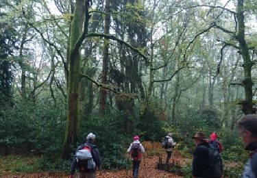
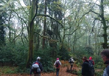
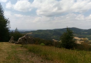
Circuit agréable, bons chemins même à la mi-février. Certainement très ombragé l'été. Le détour pour éviter la propriété privée "Les Vaillants" est envahie par de jeunes résineux, je pense qu'il est possible de traverser cette propriété par le chemin de gauche mais je n'ai pas essayé.


Trails nearby

Trail On foot Glux-en-Glenne - Le Tour des Remparts - Photo
On foot
PRO

On foot

Easy
Glux-en-Glenne, Bourgogne-Franche-Comté, Nièvre, France
4.9 km | 6.8 km-effort
1h 32min
Yes
Trail On foot Glux-en-Glenne - Le Chemin de Maraude - Photo
On foot
PRO

On foot

Easy
Glux-en-Glenne, Bourgogne-Franche-Comté, Nièvre, France
3.1 km | 4 km-effort
54min
Yes
Trail Walking Saint-Léger-sous-Beuvray - 181007 SVG - Photo
Walking
MarcheEtReve

Walking

Very easy
Saint-Léger-sous-Beuvray, Bourgogne-Franche-Comté, Saône-et-Loire, France
9.3 km | 13.5 km-effort
4h 1min
Yes
Trail Walking Saint-Léger-sous-Beuvray - 181007 EnCours-2 - Photo
Walking
MarcheEtReve

Walking

Very easy
Saint-Léger-sous-Beuvray, Bourgogne-Franche-Comté, Saône-et-Loire, France
9.3 km | 13.5 km-effort
4h 1min
Yes
Trail Walking Glux-en-Glenne - Marche Expérimentale Légion VIII Augusta - Bibracte - Arleuf - Photo
Walking
tracegps

Walking

Difficult
Glux-en-Glenne, Bourgogne-Franche-Comté, Nièvre, France
19.3 km | 27 km-effort
5h 0min
No
Trail Walking Glux-en-Glenne - Glux - Mt Beuvray - Photo
Walking
meunier.ph.

Walking

Easy
Glux-en-Glenne, Bourgogne-Franche-Comté, Nièvre, France
14 km | 21 km-effort
2h 47min
Yes
Trail Walking Saint-Prix - Haut Folin  Bois du Roi  31.08.2021 Morvan  - Photo
Walking
lestetinesvertes

Walking

Medium
Saint-Prix, Bourgogne-Franche-Comté, Saône-et-Loire, France
5.1 km | 6.7 km-effort
2h 3min
Yes
Trail Walking Saint-Léger-sous-Beuvray - Oppidum de Bibracte - Photo
Walking
francoisecarlier

Walking

Very easy
Saint-Léger-sous-Beuvray, Bourgogne-Franche-Comté, Saône-et-Loire, France
9 km | 13.1 km-effort
3h 14min
Yes
Trail Walking Saint-Léger-sous-Beuvray - Bibracte autour du Montt Breuvay - Photo
Walking
hueco

Walking

Difficult
Saint-Léger-sous-Beuvray, Bourgogne-Franche-Comté, Saône-et-Loire, France
20 km | 29 km-effort
5h 0min
Yes


Close
My subscriptions