


w-frankrijk-pad-naar-plaisance-in-de-aveyron

gpstracks
User
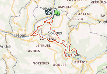

Length
16.7 km

Max alt
438 m

Uphill gradient
621 m
Km-Effort
25 km

Min alt
217 m

Downhill gradient
642 m
Boucle
Yes
Creation date :
2014-12-10 00:00:00.0
Updated on :
2014-12-10 00:00:00.0
--
Difficulty : Unknown

FREE GPS app for hiking
 SityTrail
IGN / Geographical institutes
SityTrail Plus
The world is yours!
About
Trail Walking of 16.7 km to be discovered at Occitania, Aveyron, La Bastide-Solages. This trail is proposed by gpstracks.
Description
More information on GPStracks.nl : http://www.gpstracks.nl


Positioning
Country:
France
Region :
Occitania
Department/Province :
Aveyron
Municipality :
La Bastide-Solages
Location:
Unknown
Start:(Dec)
Start:(UTM)
461604 ; 4867128 (31T) N.
Comments