


malvies 3

bouscaillou
User
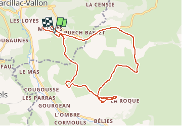

Length
10.4 km

Max alt
574 m

Uphill gradient
224 m
Km-Effort
13.4 km

Min alt
462 m

Downhill gradient
223 m
Boucle
Yes
Creation date :
2021-05-18 12:08:40.882
Updated on :
2021-05-18 14:32:36.205
2h22
Difficulty : Difficult

FREE GPS app for hiking
 SityTrail
IGN / Geographical institutes
SityTrail Plus
The world is yours!
About
Trail Walking of 10.4 km to be discovered at Occitania, Aveyron, Marcillac-Vallon. This trail is proposed by bouscaillou.
Positioning
Country:
France
Region :
Occitania
Department/Province :
Aveyron
Municipality :
Marcillac-Vallon
Location:
Unknown
Start:(Dec)
Start:(UTM)
458407 ; 4923855 (31T) N.
Comments