


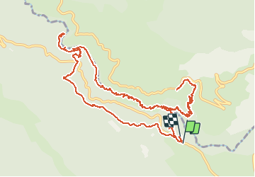
La Maline-Imbut-Vidal

ETMU5496
User


4h14
Difficulty : Difficult

FREE GPS app for hiking
 SityTrail
IGN / Geographical institutes
SityTrail Plus
The world is yours!
About
Trail Walking of 17.1 km to be discovered at Provence-Alpes-Côte d'Azur, Var, Aiguines. This trail is proposed by ETMU5496.
Description
Départ Auberge des Cavaliers
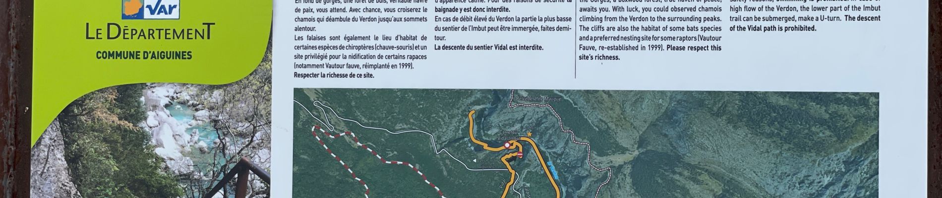
Descendre vers le lit du Verdon, passer la passerelle et monter au chalet de la Maline.
Redecendre à la passerelle et prendre le sentier de l'imbut jusqu'au bout du chemin.
Revenir en arrière pour emprunter le Sentier Vidal qui monte assez fort. Regagner ensuite le point de départ.
Randonnée assez technique à ne privilégier que par temps sec
Photos


75 photos in total. Please click on a photo to see them all in the gallery.
Positioning
Comments