


rando pivoines

vincente204
User

Length
17.5 km

Max alt
1492 m

Uphill gradient
428 m
Km-Effort
23 km

Min alt
1121 m

Downhill gradient
431 m
Boucle
Yes
Creation date :
2021-05-19 07:57:46.301
Updated on :
2021-05-19 14:32:05.333
6h33
Difficulty : Difficult

FREE GPS app for hiking
 SityTrail
IGN / Geographical institutes
SityTrail Plus
The world is yours!
About
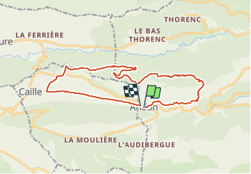
Trail Walking of 17.5 km to be discovered at Provence-Alpes-Côte d'Azur, Maritime Alps, Andon. This trail is proposed by vincente204.
Description
facile
Positioning
Country:
France
Region :
Provence-Alpes-Côte d'Azur
Department/Province :
Maritime Alps
Municipality :
Andon
Location:
Unknown
Start:(Dec)
Start:(UTM)
321781 ; 4849078 (32T) N.
Comments