


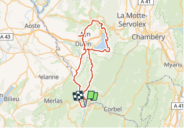
les celles lac aiguebelette

BELLETGE
User

Length
58 km

Max alt
598 m

Uphill gradient
1075 m
Km-Effort
72 km

Min alt
266 m

Downhill gradient
1075 m
Boucle
Yes
Creation date :
2021-05-20 11:24:47.652
Updated on :
2021-05-20 16:20:24.044
3h07
Difficulty : Easy

FREE GPS app for hiking
 SityTrail
IGN / Geographical institutes
SityTrail Plus
The world is yours!
About
Trail Road bike of 58 km to be discovered at Auvergne-Rhône-Alpes, Isère, Entre-deux-Guiers. This trail is proposed by BELLETGE.
Positioning
Country:
France
Region :
Auvergne-Rhône-Alpes
Department/Province :
Isère
Municipality :
Entre-deux-Guiers
Location:
Unknown
Start:(Dec)
Start:(UTM)
715188 ; 5034769 (31T) N.
Comments