


21052021 Erce en Lamee /Bonne Fontaine

chasle
User
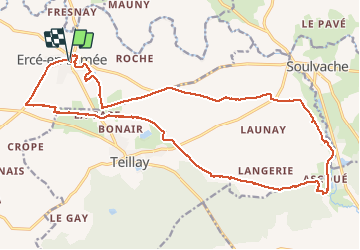

Length
23 km

Max alt
98 m

Uphill gradient
205 m
Km-Effort
26 km

Min alt
42 m

Downhill gradient
203 m
Boucle
Yes
Creation date :
2021-05-21 07:12:35.261
Updated on :
2021-05-21 18:01:40.92
4h35
Difficulty : Easy

FREE GPS app for hiking
 SityTrail
IGN / Geographical institutes
SityTrail Plus
The world is yours!
About
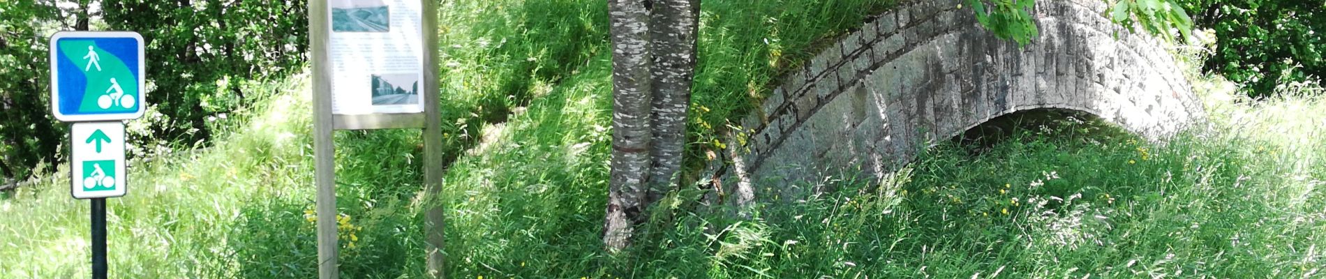
Trail Walking of 23 km to be discovered at Brittany, Ille-et-Vilaine, Ercé-en-Lamée. This trail is proposed by chasle.
Photos


23 photos in total. Please click on a photo to see them all in the gallery.
Positioning
Country:
France
Region :
Brittany
Department/Province :
Ille-et-Vilaine
Municipality :
Ercé-en-Lamée
Location:
Unknown
Start:(Dec)
Start:(UTM)
607917 ; 5298391 (30T) N.
Comments