


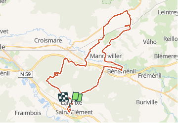
sortie vtt 23052021 laneuveville

fabwin
User GUIDE

Length
41 km

Max alt
307 m

Uphill gradient
359 m
Km-Effort
45 km

Min alt
229 m

Downhill gradient
356 m
Boucle
Yes
Creation date :
2021-05-23 06:54:05.914
Updated on :
2021-05-23 10:09:09.313
2h50
Difficulty : Easy

FREE GPS app for hiking
 SityTrail
IGN / Geographical institutes
SityTrail Plus
The world is yours!
About
Trail Mountain bike of 41 km to be discovered at Grand Est, Meurthe-et-Moselle, Saint-Clément. This trail is proposed by fabwin.
Positioning
Country:
France
Region :
Grand Est
Department/Province :
Meurthe-et-Moselle
Municipality :
Saint-Clément
Location:
Unknown
Start:(Dec)
Start:(UTM)
323007 ; 5378523 (32U) N.
Comments