


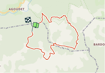
Le tour des jasses : Bourdils Chavardes Landres Bramefan

yt34
User

Length
10.1 km

Max alt
1062 m

Uphill gradient
358 m
Km-Effort
14.8 km

Min alt
763 m

Downhill gradient
348 m
Boucle
No
Creation date :
2021-05-23 08:47:37.831
Updated on :
2021-05-25 06:29:34.728
3h09
Difficulty : Medium

FREE GPS app for hiking
 SityTrail
IGN / Geographical institutes
SityTrail Plus
The world is yours!
About
Trail Walking of 10.1 km to be discovered at Occitania, Hérault, Saint-Julien. This trail is proposed by yt34.
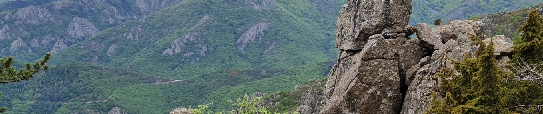
Photos


34 photos in total. Please click on a photo to see them all in the gallery.
Positioning
Country:
France
Region :
Occitania
Department/Province :
Hérault
Municipality :
Saint-Julien
Location:
Unknown
Start:(Dec)
Start:(UTM)
491972 ; 4827480 (31T) N.
Comments