


Carbonne abris 2021 fait

pidjam
User
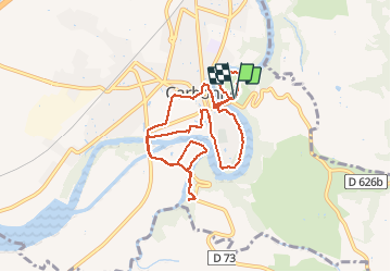

Length
10.1 km

Max alt
252 m

Uphill gradient
153 m
Km-Effort
12.2 km

Min alt
191 m

Downhill gradient
157 m
Boucle
Yes
Creation date :
2021-05-23 12:11:37.704
Updated on :
2021-05-23 14:58:54.101
2h46
Difficulty : Medium

FREE GPS app for hiking
 SityTrail
IGN / Geographical institutes
SityTrail Plus
The world is yours!
About
Trail Walking of 10.1 km to be discovered at Occitania, Haute-Garonne, Carbonne. This trail is proposed by pidjam.
Positioning
Country:
France
Region :
Occitania
Department/Province :
Haute-Garonne
Municipality :
Carbonne
Location:
Unknown
Start:(Dec)
Start:(UTM)
356447 ; 4795101 (31T) N.
Comments