


27 05 21les brosses

Jacky Fumey
User

Length
7.1 km

Max alt
522 m

Uphill gradient
178 m
Km-Effort
9.5 km

Min alt
415 m

Downhill gradient
182 m
Boucle
Yes
Creation date :
2021-05-27 11:16:56.125
Updated on :
2021-05-27 14:22:31.059
3h04
Difficulty : Easy

FREE GPS app for hiking
 SityTrail
IGN / Geographical institutes
SityTrail Plus
The world is yours!
About
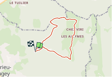
Trail Walking of 7.1 km to be discovered at Auvergne-Rhône-Alpes, Ain, Ambérieu-en-Bugey. This trail is proposed by Jacky Fumey.
Positioning
Country:
France
Region :
Auvergne-Rhône-Alpes
Department/Province :
Ain
Municipality :
Ambérieu-en-Bugey
Location:
Unknown
Start:(Dec)
Start:(UTM)
684406 ; 5092969 (31T) N.
Comments