


Le lac du Barbat avec Jacky

mitch1952
User
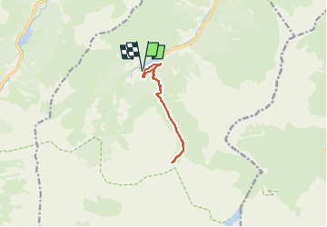

Length
9.2 km

Max alt
1976 m

Uphill gradient
800 m
Km-Effort
19.8 km

Min alt
1169 m

Downhill gradient
800 m
Boucle
Yes
Creation date :
2021-05-27 19:57:28.793
Updated on :
2022-06-08 13:46:08.618
4h30
Difficulty : Very difficult

FREE GPS app for hiking
 SityTrail
IGN / Geographical institutes
SityTrail Plus
The world is yours!
About
Trail Walking of 9.2 km to be discovered at Occitania, Hautespyrenees, Estaing. This trail is proposed by mitch1952.
Points of interest


Positioning
Country:
France
Region :
Occitania
Department/Province :
Hautespyrenees
Municipality :
Estaing
Location:
Unknown
Start:(Dec)
Start:(UTM)
727639 ; 4753982 (30T) N.
Comments