


2805

maxEA65
User
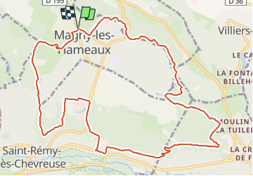

Length
13.6 km

Max alt
168 m

Uphill gradient
193 m
Km-Effort
16.2 km

Min alt
78 m

Downhill gradient
194 m
Boucle
Yes
Creation date :
2021-05-28 06:41:22.208
Updated on :
2021-05-28 10:17:42.331
3h35
Difficulty : Difficult

FREE GPS app for hiking
 SityTrail
IGN / Geographical institutes
SityTrail Plus
The world is yours!
About
Trail Walking of 13.6 km to be discovered at Ile-de-France, Yvelines, Magny-les-Hameaux. This trail is proposed by maxEA65.
Positioning
Country:
France
Region :
Ile-de-France
Department/Province :
Yvelines
Municipality :
Magny-les-Hameaux
Location:
Unknown
Start:(Dec)
Start:(UTM)
432525 ; 5397422 (31U) N.
Comments