


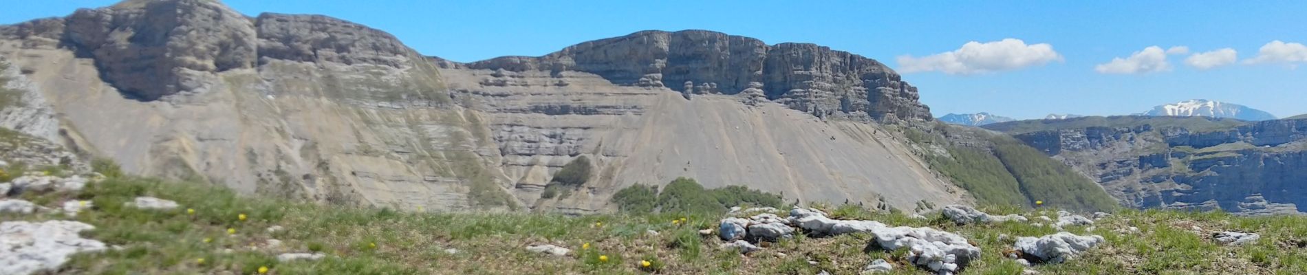
Pas de la Ferrière

ezorzet
User
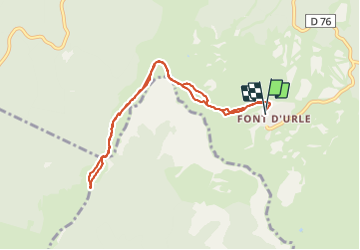

Length
8.6 km

Max alt
1665 m

Uphill gradient
462 m
Km-Effort
14.8 km

Min alt
1440 m

Downhill gradient
465 m
Boucle
Yes
Creation date :
2021-05-28 07:47:23.466
Updated on :
2021-05-28 13:05:06.59
3h56
Difficulty : Easy

FREE GPS app for hiking
 SityTrail
IGN / Geographical institutes
SityTrail Plus
The world is yours!
About
Trail Walking of 8.6 km to be discovered at Auvergne-Rhône-Alpes, Drôme, Bouvante. This trail is proposed by ezorzet.
Description
Pas de la Ferrière départ Font D'Urle.
Photos


Positioning
Country:
France
Region :
Auvergne-Rhône-Alpes
Department/Province :
Drôme
Municipality :
Bouvante
Location:
Unknown
Start:(Dec)
Start:(UTM)
683196 ; 4974440 (31T) N.
Comments