


Col de la Haugade 3 001

mitch1952
User
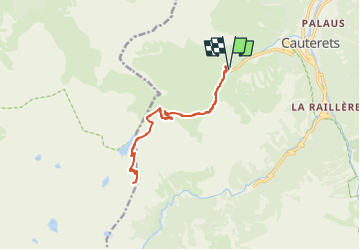

Length
14.5 km

Max alt
2361 m

Uphill gradient
1003 m
Km-Effort
28 km

Min alt
1347 m

Downhill gradient
1001 m
Boucle
Yes
Creation date :
2021-05-29 13:14:57.314
Updated on :
2022-06-08 13:47:54.008
6h19
Difficulty : Very difficult

FREE GPS app for hiking
 SityTrail
IGN / Geographical institutes
SityTrail Plus
The world is yours!
About
Trail Walking of 14.5 km to be discovered at Occitania, Hautespyrenees, Cauterets. This trail is proposed by mitch1952.
Positioning
Country:
France
Region :
Occitania
Department/Province :
Hautespyrenees
Municipality :
Cauterets
Location:
Unknown
Start:(Dec)
Start:(UTM)
733351 ; 4751717 (30T) N.
Comments