


aleyrac-espuy1

parastat
User
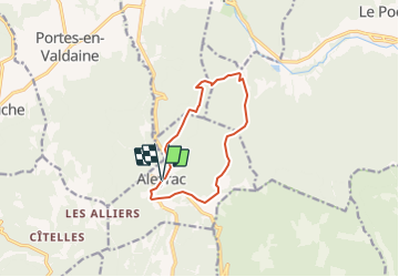

Length
10.2 km

Max alt
562 m

Uphill gradient
328 m
Km-Effort
14.6 km

Min alt
279 m

Downhill gradient
338 m
Boucle
Yes
Creation date :
2021-05-29 13:48:33.971
Updated on :
2021-05-29 13:49:02.792
3h19
Difficulty : Difficult

FREE GPS app for hiking
 SityTrail
IGN / Geographical institutes
SityTrail Plus
The world is yours!
About
Trail Walking of 10.2 km to be discovered at Auvergne-Rhône-Alpes, Drôme, Aleyrac. This trail is proposed by parastat.
Positioning
Country:
France
Region :
Auvergne-Rhône-Alpes
Department/Province :
Drôme
Municipality :
Aleyrac
Location:
Unknown
Start:(Dec)
Start:(UTM)
654194 ; 4929160 (31T) N.
Comments