


vtt-mesanger-couffe-2021-04-23-14-48-48-on-alltrails

Marco44
User
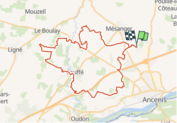

Length
45 km

Max alt
67 m

Uphill gradient
359 m
Km-Effort
50 km

Min alt
9 m

Downhill gradient
360 m
Boucle
Yes
Creation date :
2021-05-30 06:48:26.898
Updated on :
2021-05-30 06:48:26.898

FREE GPS app for hiking
 SityTrail
IGN / Geographical institutes
SityTrail Plus
The world is yours!
About
Trail of 45 km to be discovered at Pays de la Loire, Loire-Atlantique, Mésanger. This trail is proposed by Marco44.
Description
un circuit avec de la route des chemins et de super dénivelés super pour les sportifs
Positioning
Country:
France
Region :
Pays de la Loire
Department/Province :
Loire-Atlantique
Municipality :
Mésanger
Location:
Unknown
Start:(Dec)
Start:(UTM)
635250 ; 5252805 (30T) N.
Comments