Trail  Mésanger - vtt-mesanger-couffe-2021-04-23-14-48-48-on-alltrails - Photo

vtt-mesanger-couffe-2021-04-23-14-48-48-on-alltrails

 Marco44
Marco44

User

© OpenStreetMap contributors
Length
Length
45 km
Max alt
Max alt
67 m
Uphill gradient
Uphill gradient
359 m
Km-Effort
Km-Effort  
50 km
Min alt
Min alt
9 m
Downhill gradient
Downhill gradient
360 m
Boucle
Boucle
Yes
Creation date :
2021-05-30 06:48:26.898
Updated on :
2021-05-30 06:48:26.898

(0 Reviews)


Scan this QR Code to open this trail in the SityTrail application

FREE GPS app for hiking

Logo SityTrail SityTrail

IGN / Geographical institutes

Download SityTrail from the App Store Download SityTrail from Google Play

Logo SityTrail SityTrail World

The world is yours!

Download SityTrail from the App Store Download SityTrail from Google Play Download SityTrail on Huawei AppGallery

About

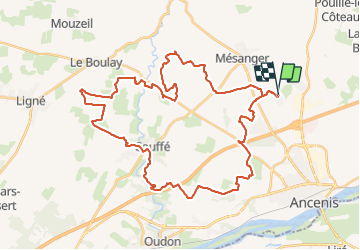
Trail of 45 km to be discovered at Pays de la Loire, Loire-Atlantique, Mésanger. This trail is proposed by Marco44.

Description

un circuit avec de la route des chemins et de super dénivelés super pour les sportifs

Elevation profile

Positioning

Country:
France
Region :
Pays de la Loire
Department/Province :
Loire-Atlantique
Municipality :
Mésanger
Location:
Unknown
Start:(UTM)
635250 ; 5252805 (30T) N.

Trails nearby

Trail Walking Ancenis-Saint-Géréon - garage delestre - Photo
Walking
Joseph F.

Walking

Easy
Ancenis-Saint-Géréon, Pays de la Loire, Loire-Atlantique, France
3.4 km | 3.8 km-effort
51min
No
Trail Walking Ancenis-Saint-Géréon - Marais de grée - Photo
Walking
Poulpy77

Walking

Very easy
Ancenis-Saint-Géréon, Pays de la Loire, Loire-Atlantique, France
2.3 km | 2.6 km-effort
32min
Yes
Trail Walking Ancenis-Saint-Géréon - 2017-6-15 Marais de Grée VO - Photo
Walking
monted4460

Walking

Very easy
Ancenis-Saint-Géréon, Pays de la Loire, Loire-Atlantique, France
8.3 km | 9.1 km-effort
2h 0min
Yes


Close
My subscriptions