


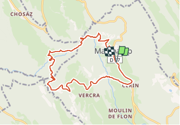
01 Ain Cerin

trietsch
User

Length
9.8 km

Max alt
660 m

Uphill gradient
398 m
Km-Effort
15.2 km

Min alt
356 m

Downhill gradient
401 m
Boucle
Yes
Creation date :
2021-05-30 09:12:32.0
Updated on :
2021-05-30 19:07:58.094
3h06
Difficulty : Difficult

FREE GPS app for hiking
 SityTrail
IGN / Geographical institutes
SityTrail Plus
The world is yours!
About
Trail Walking of 9.8 km to be discovered at Auvergne-Rhône-Alpes, Ain, Marchamp. This trail is proposed by trietsch.
Description
Balade proposé par dominique
Bien à l'ombre à faire en été
Positioning
Country:
France
Region :
Auvergne-Rhône-Alpes
Department/Province :
Ain
Municipality :
Marchamp
Location:
Unknown
Start:(Dec)
Start:(UTM)
697692 ; 5073201 (31T) N.
Comments