


Ponthierry les vives-eaux 02/06/2021

robinier
User
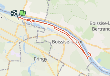

Length
8.4 km

Max alt
47 m

Uphill gradient
52 m
Km-Effort
9.1 km

Min alt
35 m

Downhill gradient
52 m
Boucle
Yes
Creation date :
2021-06-02 07:02:24.0
Updated on :
2021-06-02 10:04:39.379
3h00
Difficulty : Easy

FREE GPS app for hiking
 SityTrail
IGN / Geographical institutes
SityTrail Plus
The world is yours!
About
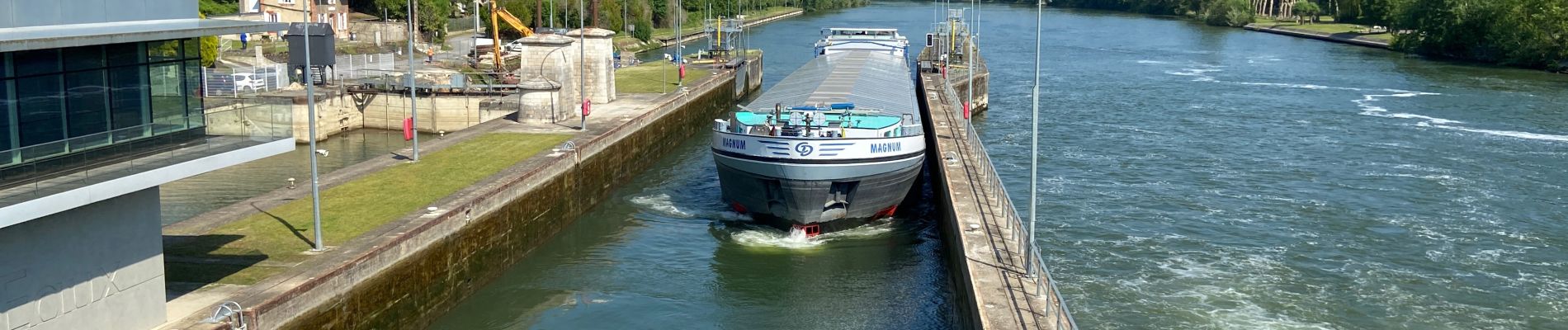
Trail Walking of 8.4 km to be discovered at Ile-de-France, Seine-et-Marne, Saint-Fargeau-Ponthierry. This trail is proposed by robinier.
Photos


Positioning
Country:
France
Region :
Ile-de-France
Department/Province :
Seine-et-Marne
Municipality :
Saint-Fargeau-Ponthierry
Location:
Unknown
Start:(Dec)
Start:(UTM)
466527 ; 5376002 (31U) N.
Comments