


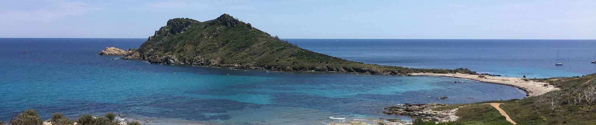
Cap Lardier,Cap Taillat par le col de Collebasse

BerFran
User
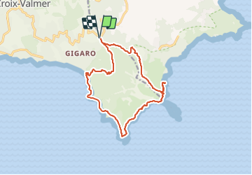

Length
15.8 km

Max alt
196 m

Uphill gradient
464 m
Km-Effort
22 km

Min alt
0 m

Downhill gradient
463 m
Boucle
Yes
Creation date :
2021-06-01 07:40:48.0
Updated on :
2021-06-02 16:00:18.173
6h00
Difficulty : Medium

FREE GPS app for hiking
 SityTrail
IGN / Geographical institutes
SityTrail Plus
The world is yours!
About
Trail Walking of 15.8 km to be discovered at Provence-Alpes-Côte d'Azur, Var, Ramatuelle. This trail is proposed by BerFran.
Photos

Positioning
Country:
France
Region :
Provence-Alpes-Côte d'Azur
Department/Province :
Var
Municipality :
Ramatuelle
Location:
Unknown
Start:(Dec)
Start:(UTM)
305710 ; 4785298 (32T) N.
Comments