


augas cass fontaine

Yannick.Boireau
User

Length
10.5 km

Max alt
155 m

Uphill gradient
172 m
Km-Effort
12.8 km

Min alt
95 m

Downhill gradient
169 m
Boucle
Yes
Creation date :
2021-06-01 07:20:49.746
Updated on :
2021-06-02 20:14:57.014
2h27
Difficulty : Difficult

FREE GPS app for hiking
 SityTrail
IGN / Geographical institutes
SityTrail Plus
The world is yours!
About
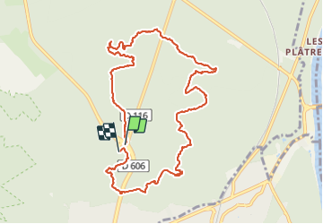
Trail Walking of 10.5 km to be discovered at Ile-de-France, Seine-et-Marne, Fontainebleau. This trail is proposed by Yannick.Boireau.
Positioning
Country:
France
Region :
Ile-de-France
Department/Province :
Seine-et-Marne
Municipality :
Fontainebleau
Location:
Unknown
Start:(Dec)
Start:(UTM)
478450 ; 5363556 (31U) N.
Comments