


Mazaugues les Arches

cousam
User
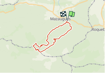

Length
13.5 km

Max alt
901 m

Uphill gradient
505 m
Km-Effort
20 km

Min alt
510 m

Downhill gradient
504 m
Boucle
Yes
Creation date :
2021-06-03 09:39:17.808
Updated on :
2021-06-03 17:34:19.276
4h29
Difficulty : Medium

FREE GPS app for hiking
 SityTrail
IGN / Geographical institutes
SityTrail Plus
The world is yours!
About
Trail Walking of 13.5 km to be discovered at Provence-Alpes-Côte d'Azur, Var, Mazaugues. This trail is proposed by cousam.
Description
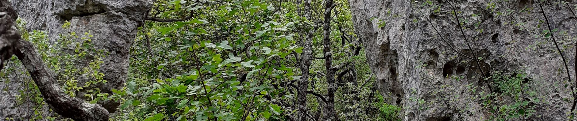
Montée par le petit sentier très sympa ,pour éviter le GR.
Aller à la recherche des arches,assez dissimulés par les arbres.
Retour par le sentier du vallon du Thuya.
(jackie Dominique)
Photos


Positioning
Country:
France
Region :
Provence-Alpes-Côte d'Azur
Department/Province :
Var
Municipality :
Mazaugues
Location:
Unknown
Start:(Dec)
Start:(UTM)
737521 ; 4803375 (31T) N.
Comments
belle rando de beaux arches
BIEN