


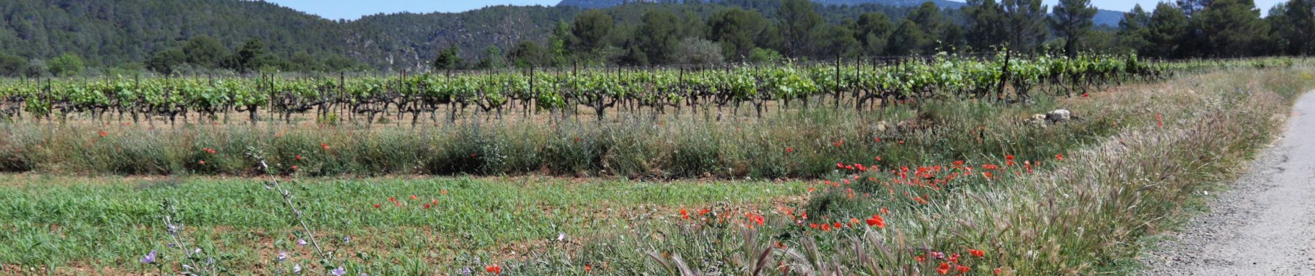
Correns_le plateau de Merindol

bernir
User
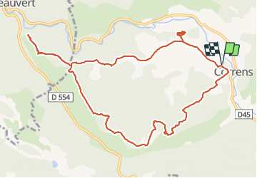

Length
13.4 km

Max alt
337 m

Uphill gradient
274 m
Km-Effort
17 km

Min alt
164 m

Downhill gradient
274 m
Boucle
Yes
Creation date :
2021-06-04 07:49:04.961
Updated on :
2021-06-04 17:59:47.496
6h26
Difficulty : Easy

FREE GPS app for hiking
 SityTrail
IGN / Geographical institutes
SityTrail Plus
The world is yours!
About
Trail Walking of 13.4 km to be discovered at Provence-Alpes-Côte d'Azur, Var, Correns. This trail is proposed by bernir.
Photos


Positioning
Country:
France
Region :
Provence-Alpes-Côte d'Azur
Department/Province :
Var
Municipality :
Correns
Location:
Unknown
Start:(Dec)
Start:(UTM)
263741 ; 4819236 (32T) N.
Comments